
Fort Good Hope & south
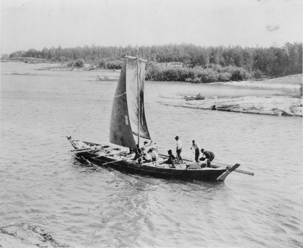
In May 1852, Chief Trader James Anderson (A), who was then in charge of the Mackenzie River District, made a journey to Fort Good Hope, on the Mackenzie River north of the Ramparts discussed in the last blogpost in this series. Here is his journal, written as his boat drifted down the Mackenzie River from Fort Norman to Fort Good Hope, passing through the Ramparts of the Mackenzie River.
Monday 24th…Remained about 2 hours [at Fort Norman]. Carried sail till about 2 pm, when we were compelled to encamp through head wind and heavy rain near Stewart’s Island in the Long Reach below Bear River. The poplars and birch are here only in bud; at Fort Simpson they were in full leaf. The Mackenzie broke at Fort Norman on the 9th [May].
He is talking about the new location of Fort Norman, and not the old. Old Fort Norman had been flooded out a year or two earlier, and the new Fort was in process of being rebuilt in a location that was not so convenient for the Dogribs, the local First Nations that traded furs with them. Anderson’s journal continues:
Tuesday 25th. Wind fell about 10 a.m. when we left. Drifted all night.
Wednesday 26th. Arrived at Fort Good Hope about mid-day. This is a clean, well-arranged place which does credit to its manager. The ice broke opposite the Fort on the 9th instant, but the ice from the ramparts only came down on the 21st.
Of course, it was the narrow section of river through the Ramparts that clogged up every spring, flooding the upper river posts to the south if the clog was severe enough. As Fort Good Hope was north of the narrow section of the Mackenzie’s River, it might not have been threatened by floods — but the Ramparts plateau, and Ramparts River, was north and east of the post. Certainly there must have been times when they could not travel the river because of the blockages of ice in the narrows of the Ramparts. The note above indicates the river blocked south of the post, where the river was squeezed by the Ramparts Plateau. Anderson’s journal continues, hopefully with his return journey to Fort Norman after his work was done at Fort Good Hope.
Thursday 27th. Remained at the Fort arranging the affairs (written to Messrs. Peers, Campbell, Hardisty, etc.)
At this time, May 1852, Augustus Richard Peers was in charge at the Peel’s River Post. Robert Campbell and James Green Stewart were either at Fort Selkirk, on the Pelly River, or making the journey north via the Porcupine River to pick up their goods at Lapierre’s House. William Lucas Hardisty was in charge at Fort Yukon, on the Yukon River west of Fort Selkirk. So, let’s continue with Anderson’s journal.
As you see, below, he sailed upriver from Fort Good Hope, breakfasting at the head of Sans Sault Rapids, which in his book, Northwest Territories, Jamie Bastedo describes as “the most difficult and dangerous section of the river to navigate. They are formed by a rocky limestone ledge that extends far into midstream from the curved east bank. In high water, four-foot waves bound from the boulder-strewn riverbed. In low water, waves exceeding eight feet have been recorded at these rapids. Regardless of water levels, Keep left!” — and remember, always, that he is talking about coming downstream, not going up. Anderson’s crew must have followed the right or west bank of the Mackenzie River to pass this set of rapids.
Friday 28th. Left at mid-day. Had a light breeze and carried sail all night. Mrs. McBeath and family are passengers with us.
Saturday 29th. Breakfasted at the head of the Sans Sault Rapid[s] & encamped at 9 1/2 p.m. above Les Rochers Rouge. Carried sail with a light breeze half the day.
Angus McBeath was in charge at Fort Good Hope from 1846 to 1854, so why his family was travelling out I do not know. Perhaps he was temporarily placed in charge of another post, and sent wife and children out ahead of his departure. Mrs. McBeath might even have travelled out to have a child in the safety of Fort Simpson: again, we do not know.
But to continue the journey up the Mackenzie: this stretch of the river between modern-day Norman Wells down to Tsiigehtchic (well on the way to Fort McPherson) is described as the most scenic part of the Mackenzie. I even found what must be “Les Rochers Rouge” mentioned! Here we are: From Bastedo’s Mackenzie River:
You may see what looks like fossilized dinosaur testicles spilling out of the high, loose banks below Perry Island. These rusty-coloured cannonball-like objects are actually concretions formed in ancient sediments through an electro chemical process that causes particles to glom together in a spherical shape.
So if you are travelling up or down the Mackenzie River, keep your eye open for what looks like “Dinosaur Testicles!” Next in James Anderson’s journal comes the Long Reach: and it does appear to be a long, straight stretch of river leading south-east all the way to Norman Wells — the modern-day town that might have replaced Fort Norman. Norman Wells is situated opposite Bear Island, and the new Fort Norman was built at the mouth of the Bear River, so I presume I am correct. (But as you will see further down the page, I am not!)
Sunday 30th. Hauled line all day. Water falling. Encamped at the beginning of the Long Reach. Embarked at 4 a.m., encamped at 8 p.m.
Monday 31st [May]. Wind strong ahead, and very cold. Left at 4 a.m.; encamped 8 pm.m. Saw an Indian.
June, Tuesday 1st. Left at 3 1/2 a.m. Strong head wind; water very low, falling fast. Stopped 4 hours at Fort Norman; encamped 8 p.m. above the Boucane.
So what’s the Boucane? First, the word is hard to read; it could be anything. Jamie Bastado does not mention it. But in French the word means “smoke.” Let’s see what Robert Campbell has to say, as he makes his way upriver from Fort Good Hope in 1851. It is interesting they carved oars. That means there was no good beach for tracking, and they would row their way upriver — as you see, through the Ramparts:
Monday 21st [July 1851]. Oars having been made and the Boat arranged this last week we started after breakfast this day, Monday 21st, and camped above the ramparts.
Tuesday 22nd. Camped below [illegible] rapids. [This is probably the Sans Sault Rapids, mentioned above].
Wednesday 23rd July 1851. Heavy rain all the past night which delayed us until 11 a.m. before we could start — at 6 p.m. it began to blow and we came on all night with [sail?] wind, until 4.
Thursday 24th. At p.m. when it entirely failed we put ashore near the upper end of the bluefish reach at 10 p.m. We came off with a fair wind again and…
Friday 25th. At 6 a.m. reached the new Fort Norman — Bear River — and breakfasted.
So as you can see, the new Fort Norman is under construction, after being flooded out, as early as 1851.
But that “Smoke.” What can this mean? Well, I looked at the Gairdner & Harrison Prospectors’ Guide Map & Pamphlet to the Omineca, Cassier, Liard, Klondyke, and Yukon Gold Fields, via the Edmonton Route, and this is what I found:
Fort Norman is easily recognized by Boat rock and the “Smokes,” or burning coal beds near the Fort. 174 miles from Norman we reach Good Hope. This post is on the border of the Arctic Circle and is the northern limit of gardens. Musk ox are not very far (about 300 miles), and Indian bring annually numerous robes to trade.
The prospectors might have called this Fort Norman, but this is the town of Norman Wells, which exists because of the oil wells that have been established there. As Jamie Bastedo says, in his book, Mackenzie River:
The first hint of the region’s petroleum potential was recorded by Alexander Mackenzie who, in 1789, was led to oil seepages by the local Sahtu Dene and described “pieces of petroleum which bear a resemblance to yellow wax.”
But the 1851 Fort Norman was south of the “Smokes” and the future location of Norman Wells. Do you remember mention of Bluefish Reach, above? Bluefish Creek is also well south of Norman Wells, as is Bear Rock, Little Bear River, and Great Bear River, which is where the second Fort Norman was built. This is where modern-day town of Tulita stands. But where was the first? South of Tulita there is a landmark titled Old Fort Point, but the fort that stood there was known to have been built in 1870.
I don’t know if you-all know about an excellent resource that exists on the internet — I have used it quite often, especially when writing the York Factory Express book. It is titled “North American Forts,” and its section on the Northwest Territories is found here: http://northamericanforts.com/Canada/nw.html
This site tells me that Fort Norman was “First a North West Co. post, originally located near the mouth of the Blackwater River.” The Blackwater River is well south of Tulita, south of Old Fort Point, and about two thirds of the way downriver to the modern-day town of Wrigley, according to the excellent maps in Jamie Bastedo’s book. To continue: “Became a Hudson’s Bay Co. post beginning in 1822, then relocated downriver in 1825 to the vicinity of the present town.” It relocated, and as it was downriver it must have been near Norman Wells, not Wrigley. “The post was relocated again in 1851. The hamlet [Tulita] was renamed in 1996.”
So there we go!When the next section of this series is published it will appear here: https://nancymargueriteanderson.com/fort-norman/
To return the the beginning of this Yukon and Mackenzie River series, go here: https://nancymargueriteanderson.com/liard-river/
Copyright, Nancy Marguerite Anderson, 2019. All rights reserved.
How interesting